
African. Safari. Experts.
Welcome to Go2Africa. Since 1998 we have been planning trips the length and breadth of the continent. The secret to our success? Our commitment to first-hand knowledge of every destination, lodge and activity we recommend. Collectively, we spend more than 365 days a year on safari to ensure you get the best, unbiased advice.
We won’t show you the world; we’ll show you Africa, better than anyone else.
 Based in Cape Town, South Africa
 3000+ safari partners across Africa
 Assistance & local know-how whenever you need it
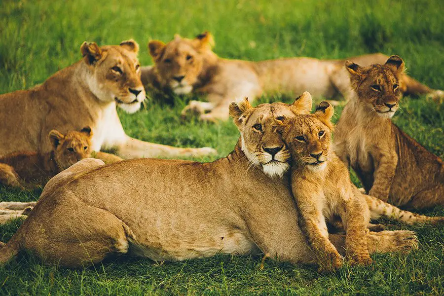
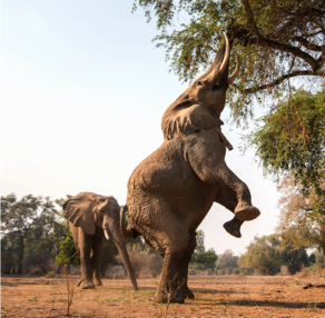
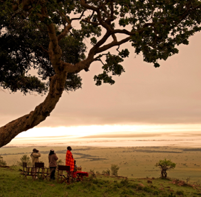
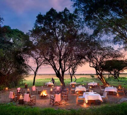
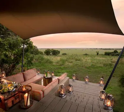
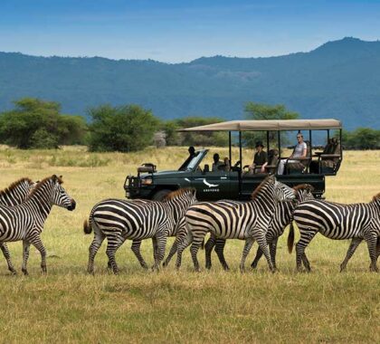
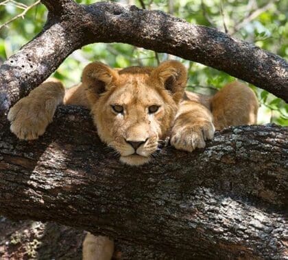
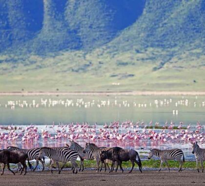
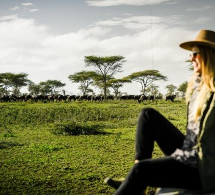
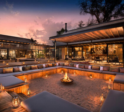
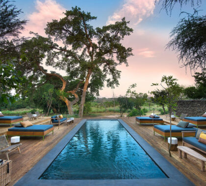
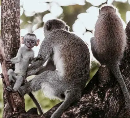
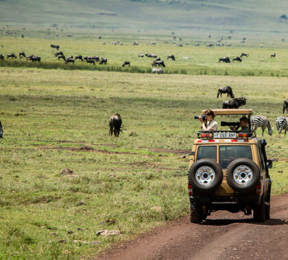
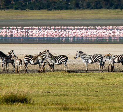
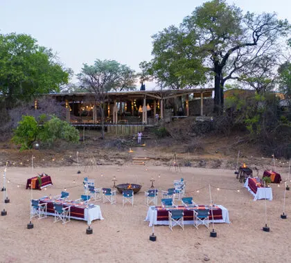
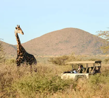
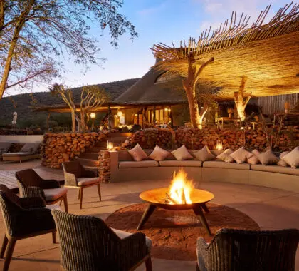
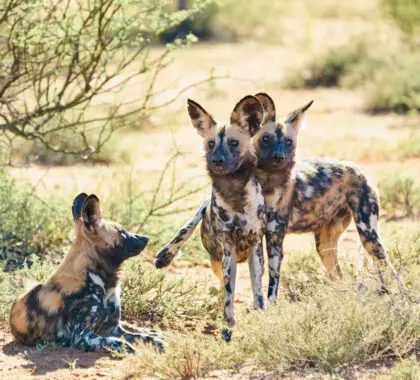
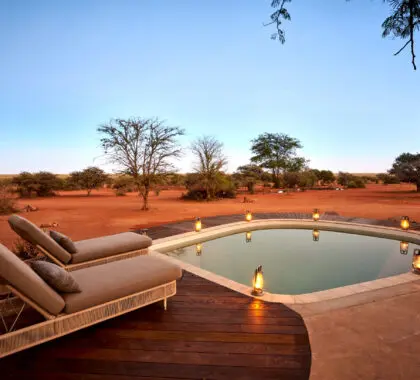
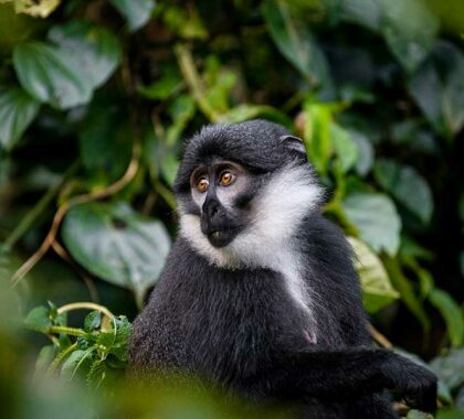
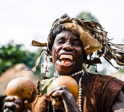
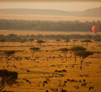
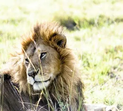
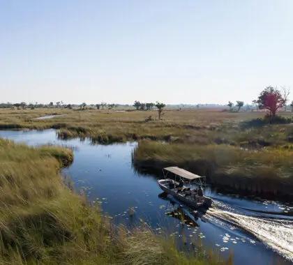
Africa's Top Wildlife Experiences
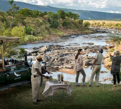
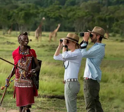
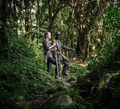
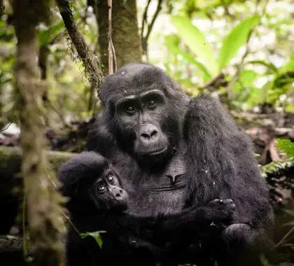
Whether you are dreaming of a first-hand meeting with the Big 5, getting up close and personal to a gorilla, witnessing one of the planet's most spectacular natural events, or simply relaxing on a pristine beach, our experts will tell you how and where to do it.
-
Resources for Planning Your First Safari
Destination Guide
Masai Mara, Serengeti or Kruger?
Arguably three of safari's heaviest hitters, each offering a truly unique experience. Choosing the best one is hard, but fortunately we've been exploring all three since 1998.
Budget Guidelines
What Does an African Safari Cost?
Always a burning question on any traveller's mind. We've crunched the numbers for you and break down safari budgets.

Top Trip Ideas
10 Best African Safari Holidays
We've compiled our favourite, tried-and-tested African safari holidays - all completely customisable to suit your travel wishes.
Why travel with Go2Africa?
Based in Cape Town, our team of experts are all born and raised in Africa.
When you travel with us you’re assured of the Big 5 Guarantee.
We Are Safari Experts
We have first-hand knowledge of every single destination, lodge and activity we recommend.
Our Best Price Promise
If you’re able to find a better quote for your itinerary let us know and we’ll match it.
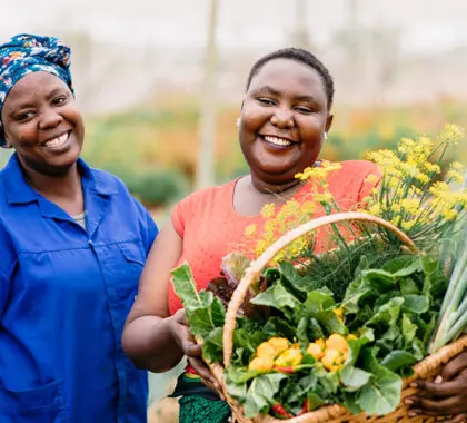
Positive Impact
The money from your trip stays in Africa, supporting local communities and conservation projects long after you return home.
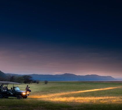
Full Service, 24/7 On Safari Support
We take care of every detail, offering 24/7 assistance and local know-how from the right time zone, until you return safely home.
Complete Financial Protection
Our clients are fully covered by our supplier default insurance, and Our accreditation bond with the Southern Africa Tourism Services Association
250
Years Curating Customised Safari Experiences
2052
Client Reviews at 5 Stars on Feefo
10
Awards Won in the Last Year
500
Lodges and Camps Visited Each Year
158400
Travellers Introduced to Africa
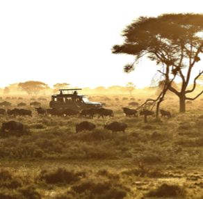
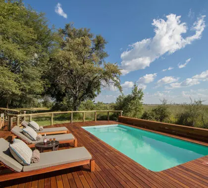
Top African Safari Destinations
Whether it’s your first safari or your twentieth, our Africa Safari Expects can tail-make any vacation to make it the trip of a lifetime, everytime. We know and love these destinations, and hope the guides will be a great starting point for your safari planning.
Trips To Inspire
Be inspired by a selection of our favourite African safari tours. From romantic honeymoons to family-friendly holidays – all completely flexible and arranged to your travel needs.
-
East Africa's Mara, Crater & Serengeti Migration Safari
Enquire for pricing
SPECIAL OFFER
Highlights
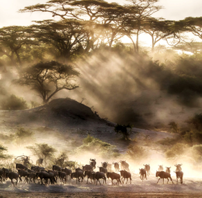
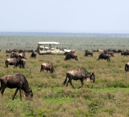
Unrivalled Big 5 game viewing. Witness the Great Migration (July to October).
Destinations visited
Kenya Lake Manyara Masai Mara Ngorongoro Crater Serengeti -
Good Value Year-Round Migration & Safari
Enquire for pricing
SPECIAL OFFER

Highlights
Great Wildebeest Migration viewing from specialist camps in Kenya or Tanzania. Full-day Ngorongoro Crater Big 5 safari in Tanzania.
Destinations visited
Arusha Kenya Lake Manyara Masai Mara Ngorongoro Crater -
Family Cape Town, Kruger & Victoria Falls
From $7,180 per person sharing
SPECIAL OFFER


Highlights
An excellent introductory, family or honeymoon trip to Africa. Explore Cape Town's beaches, Winelands and famous tourist attractions.
Destinations visited
Cape Town Kruger National Park South Africa -
Botswana's Delta, Moremi & Savute
From $6,390 per person sharing
SPECIAL OFFER

Highlights
Combine three of Botswana's top wildlife destinations. Expect excellent, up-close game viewing.
Destinations visited
Botswana Chobe National Park Okavango Delta Savuti -
East Africa Year-Round Migration Safari
Enquire for pricing
SPECIAL OFFER
Highlights
First night spent on a coffee estate with Mount Meru as your backdrop. Big Five encounters at the famed Ngorongoro Crater.
Destinations visited
Arusha Kenya Masai Mara Ngorongoro Crater Serengeti -
Community & Wildlife Luxury Safari: Kruger & the Kalahari
From $13,365 per person sharing
SPECIAL OFFER
Highlights
Search for the Big 5 in Thornybush Game Reserve. Engaging community tour at Nourish Eco Village.
Destinations visited
Kruger National Park South Africa -
East Africa's Kenya, Tanzania & Uganda & Gorillas Safari
From $18,775 per person sharing
SPECIAL OFFER
Highlights
See the extraordinary Wildebeest Migration in season. Seek out Big 5 game viewing.
Destinations visited
Arusha Kenya Masai Mara Nairobi Ngorongoro Crater
Celebrating 25 Years of Unparalleled Experience


See What Our Travellers Have To Say
-
IT IS 100% WORTH TRYING GO2AFRICA FOR YO ...
IT IS 100% WORTH TRYING GO2AFRICA FOR YOUR NEXT VACATION TRIP
QUICK REPONSES, PERFECT PLANNING, CORDIAL SERVICE
G
Glen
6 days ago

-
Stunning time in South Africa
Stunning time in South Africa
The service was wonderful. Giada developed excellent options for our stay and Carla kept us fully informed once we decided on an option.
N
Neil
6 days ago
-
Great Company and will use again
Great Company and will use again
Outstanding service and reachable when needed.
B
Benjamin
6 days ago
-
Impeccably organised once-in-a-lifetime ...
Impeccably organised once-in-a-lifetime safari experience
Go2Africa sorted everything for us - we approached them with a description of what we wanted from our holiday (a multigenerational group requiring a single malaria-free site) and they shared options w
6 days ago
-
Your Go To Africa Travel Advisor
Your Go To Africa Travel Advisor
Very attentive and professional service!
E
Ed
6 days ago
-
Wonderful trip to Kenya
Wonderful trip to Kenya
The team at Go2Africa was very professional and responsive to every question and request we had, and listened to what our goals were for this trip, and helped deliver a trip that was perfect.
6 days ago
-
Terrific service! Highly recommend!
Terrific service! Highly recommend!
very responsive and thorough!
S
Shelly
7 days ago
-
A
Amanda
7 days ago
-
Go with Go2Africa
Go with Go2Africa
Organized, great communication and coordination. Timely resolution to any minor program changes or hitches.
V
Venkat
7 days ago
-
Absolutely Fabulous!
Absolutely Fabulous!
The service was just outstanding, we can not fault the service in any way ! From the minute we made the booking until the very end - it was truly exceptional!
P
Phillipa
7 days ago
-
P
Pankti
7 days ago
-
7 days ago
-
Amazing bush, beach, and city adventure ...
Amazing bush, beach, and city adventure in Kenya!
We had a wonderful holiday arranged by Corne! She worked diligently to secure us our dream accommodation when our original’s plans changed. Her local teams in the ground were excellent, especially whe
M
Monique
11 days ago
-
Go2Africa - do it :)
Go2Africa - do it :)
Our customer experience rep Tracie was excellent in her communication. She provided us with all the details and answered questions. Her knowledge from working at a camp was invaluable as it gave first
16 days ago
-
Incredible Experience at Kapama!
Incredible Experience at Kapama!
We absolutely loved our safari and time at Kapama! From the meticulously planned trip to the incredible people we met along the way, it was better than we expected in every way. Can’t wait to go again
B
Bo
30 days ago
-
Amazing experience and organisation.
Amazing experience and organisation.
Couldn't fault, great communication from start to finish and always answered questions promptly. Felt very supported every step of the way
J
Julia
33 days ago
-
Quality customization of a great 3 weeks ...
Quality customization of a great 3 weeks in Southern Africa!
They asked me what kind of trip I would like, and custom made the perfect trip for my wants. There was an issue with an airline canceling a flight, and they were there at every call helping to rectif
G
George
33 days ago
-
Incredible African Safari
Incredible African Safari
Answered all our questions in a friendly and helpful way.
C
Cindy
35 days ago
-
Great service
Great service
Great service! Better than imagine! Highly recommend their service.
39 days ago
-
Definitely the best company to handle ou ...
Definitely the best company to handle our amazing trip! We were in the best
The absolute care, concern about our trip and communication were the best I’ve ever experienced. We had a lot of logistics to deal with in our travel, and we did not have to worry one bit about those
R
Rick
40 days ago
Where To Travel When
Timing is everything. Planning to witness the Great Wildebeest Migration in East Africa, experience a Big 5 safari in the Kruger National Park or spend your Honeymoon in the Seychelles? Explore our guidelines – based on our expert, on-the-ground knowledge of Africa’s travel seasons.
Our Top picks for January (1 of )
Southern Serengeti - Tanzania
Season | High Summer | Average Temperature for January | 17 Celsius | 63 Fahrenheit
What
Calving season during the Great Wildebeest Migration.

Our Partners
In Africa, it’s all about who you know. We understand the importance of great relationships, and that’s why we have been cultivating ours on the continent for over two decades. We’re proud to recommend these top African safari brands!


